Solar System: Things To Know This Week
Solar System: Things to Know This Week
In addition to the Mercury transit of the sun today, there are a few other things you should know about our solar system this week:
1. Mars, Ready for its Close-Up
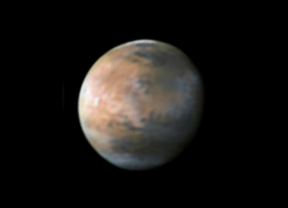
Mars will soon be closer to Earth than it has been for 11 years, presenting a great opportunity for backyard sky watchers.
2. Fire and Ice

Our spacecraft have an even closer view of Mars, and that fact regularly leads to some intriguing discoveries. The latest: volcanoes may have erupted beneath an ice sheet there billions of years ago. The above image is a mineral map of part of the Martian surface.
3. Icy Hydra

Meanwhile, our New Horizons spacecraft has sent home the first compositional data about Pluto's four small moons. The new data show the surface of Hydra is dominated by nearly pristine water ice--confirming hints that scientists picked up in images showing Hydra's highly reflective surface.
4. Ceres, Ever Sharper

The mission director for our Dawn mission writes, "Ceres, which only last year was hardly more than a fuzzy blob against the stars, is now a richly detailed world, and our portrait grows more elaborate every day."
5. Join us at Jupiter

Our Juno mission arrives at the giant planet on Jul. 4. Meanwhile, all amateur astronomers are invited to take part in a worldwide effort to identify potential observations for the spacecraft to make once it's in orbit. Find out how to join HERE.
Want to learn more? Read our full list of the 10 things to know this week about the solar system HERE.
Make sure to follow us on Tumblr for your regular dose of space: http://nasa.tumblr.com
More Posts from Nasa and Others
Is there such thing as a ‘gentle black hole’ (as in Interstellar) that would one day be a candidate for sending probes? Or is it a lost cause?
Earth’s Land Ice by the Numbers
“At a glacial pace” used to mean moving so slowly the movement is almost imperceptible. Lately though, glaciers are moving faster. Ice on land is melting and flowing, sending water to the oceans, where it raises sea levels.

In 2018, we launched the Ice, Cloud and Land Elevation Satellite-2 (ICESat-2) to continue a global record of ice elevation. Now, the results are in. Using millions of measurements from a laser in space and quite a bit of math, researchers have confirmed that Earth is rapidly losing ice.
16 Years

ICESat-2 was a follow-up mission to the original ICESat, which launched in 2003 and took measurements until 2009. Comparing the two records tells us how much ice sheets have lost over 16 years.

½ Inch
During those 16 years, melting ice from Antarctica and Greenland was responsible for just over a half-inch of sea level rise. When ice on land melts, it eventually finds its way to the ocean. The rapid melt at the poles is no exception.

400,000 Olympic Swimming Pools
One gigaton of ice holds enough water to fill 400,000 Olympic swimming pools. It’s also enough ice to cover Central Park in New York in more than 1,000 feet of ice.

200 Gigatons
Between 2003 and 2019, Greenland lost 200 gigatons of ice per year. That’s 80 million Olympic swimming pools reaching the ocean every year, just from Greenland alone.

118 Gigatons
During the same time period, Antarctica lost 118 gigatons of ice per year. That’s another 47 million Olympic swimming pools every year. While there has been some elevation gain in the continent’s center from increased snowfall, it’s nowhere near enough to make up for how much ice is lost to the sea from coastal glaciers.

10,000 Pulses
ICESat-2 sends out 10,000 pulses of laser light a second down to Earth’s surface and times how long it takes them to return to the satellite, down to a billionth of a second. That’s how we get such precise measurements of height and changing elevation.

These numbers confirm what scientists have been finding in most previous studies and continue a long record of data showing how Earth’s polar ice is melting. ICESat-2 is a key tool in our toolbox to track how our planet is changing.
Make sure to follow us on Tumblr for your regular dose of space: http://nasa.tumblr.com.
Solar System: Things to Know This Week
We love Lucy—our spacecraft that will visit the ancient Trojan asteroids near Jupiter, that is. This week, let us count the ways this 2021 mission could revolutionize what we know about the origins of Earth and ourselves.
1. Lucky Lucy

Earlier this year, we selected the Lucy mission to make the first-ever visit to a group of asteroids known as the Trojans. This swarm of asteroids orbits in two loose groups around the Sun, with one group always ahead of Jupiter in its path, and the other always behind. The bodies are stabilized by the Sun and Jupiter in a gravitational balancing act, gathering in locations known as Lagrange points.
2. Old. Really, Really Old

Jupiter's swarms of Trojan asteroids may be remnants of the material that formed our outer planets more than 4 billion years ago—so these fossils may help reveal our most distant origins. "They hold vital clues to deciphering the history of the solar system," said Dr. Harold F. Levison, Lucy principal investigator from Southwest Research Institute (SwRI) in Boulder, Colorado.
3. A Link to The Beatles

Lucy takes its name from the fossilized human ancestor, called "Lucy" by her discoverers, whose skeleton provided unique insight into humanity's evolution. On the night it was discovered in 1974, the team's celebration included dancing and singing to The Beatles' song "Lucy In The Sky With Diamonds." At some point during that evening, expedition member Pamela Alderman named the skeleton "Lucy," and the name stuck. Jump ahead to 2013 and the mission's principal investigator, Dr. Levison, was inspired by that link to our beginnings to name the spacecraft after Lucy the fossil. The connection to The Beatles' song was just icing on the cake.
4. Travel Itinerary
One of two missions selected in a highly competitive process, Lucy will launch in October 2021. With boosts from Earth's gravity, it will complete a 12-year journey to seven different asteroids: a Main Belt asteroid and six Trojans.
5. Making History

No other space mission in history has been launched to as many different destinations in independent orbits around the Sun. Lucy will show us, for the first time, the diversity of the primordial bodies that built the planets.
6. What Lies Beneath
Lucy's complex path will take it to both clusters of Trojans and give us our first close-up view of all three major types of bodies in the swarms (so-called C-, P- and D-types). The dark-red P- and D-type Trojans resemble those found in the Kuiper Belt of icy bodies that extends beyond the orbit of Neptune. The C-types are found mostly in the outer parts of the Main Belt of asteroids, between the orbits of Mars and Jupiter. All of the Trojans are thought to be abundant in dark carbon compounds. Below an insulating blanket of dust, they are probably rich in water and other volatile substances.
7. Pretzel, Anyone?

This diagram illustrates Lucy's orbital path. The spacecraft's path (green) is shown in a slowly turning frame of reference that makes Jupiter appear stationary, giving the trajectory its pretzel-like shape.
8. Moving Targets

This time-lapsed animation shows the movements of the inner planets (Mercury, brown; Venus, white; Earth, blue; Mars, red), Jupiter (orange), and the two Trojan swarms (green) during the course of the Lucy mission.
9. Long To-Do List
Lucy and its impressive suite of remote-sensing instruments will study the geology, surface composition, and physical properties of the Trojans at close range. The payload includes three imaging and mapping instruments, including a color imaging and infrared mapping spectrometer and a thermal infrared spectrometer. Lucy also will perform radio science investigations using its telecommunications system to determine the masses and densities of the Trojan targets.
10. Dream Team
Several institutions will come together to successfully pull off this mission. The Southwest Research Institute in Boulder, Colorado, is the principal investigator institution. Our Goddard Space Flight Center will provide overall mission management, systems engineering, and safety and mission assurance. Lockheed Martin Space Systems in Denver will build the spacecraft. Instruments will be provided by Goddard, the Johns Hopkins Applied Physics Laboratory and Arizona State University. Discovery missions are overseen by the Planetary Missions Program Office at our Marshall Space Flight Center in Huntsville, Alabama, for our Planetary Science Division.
Make sure to follow us on Tumblr for your regular dose of space: http://nasa.tumblr.com
Celebrating 17 Years of NASA’s ‘Little Earth Satellite That Could’
The satellite was little— the size of a small refrigerator; it was only supposed to last one year and constructed and operated on a shoestring budget — yet it persisted.
After 17 years of operation, more than 1,500 research papers generated and 180,000 images captured, one of NASA’s pathfinder Earth satellites for testing new satellite technologies and concepts comes to an end on March 30, 2017. The Earth Observing-1 (EO-1) satellite will be powered off on that date but will not enter Earth’s atmosphere until 2056.
“The Earth Observing-1 satellite is like The Little Engine That Could,” said Betsy Middleton, project scientist for the satellite at NASA’s Goddard Space Flight Center in Greenbelt, Maryland.
To celebrate the mission, we’re highlighting some of EO-1’s notable contributions to scientific research, spaceflight advancements and society.
Scientists Learn More About Earth in Fine Detail

This animation shifts between an image showing flooding that occurred at the Arkansas and Mississippi rivers on January 12, 2016, captured by ALI and the rivers at normal levels on February 14, 2015 taken by the Operational Land Imager on Landsat 8. Credit: NASA’s Earth Observatory
EO-1 carried the Advanced Land Imager that improved observations of forest cover, crops, coastal waters and small particles in the air known as aerosols. These improvements allowed researchers to identify smaller features on a local scale such as floods and landslides, which were especially useful for disaster support.

On the night of Sept. 6, 2014, EO-1’s Hyperion observed the ongoing eruption at Holuhraun, Iceland as shown in the above image. Partially covered by clouds, this scene shows the extent of the lava flows that had been erupting.
EO-1’s other key instrument Hyperion provided an even greater level of detail in measuring the chemical constituents of Earth’s surface— akin to going from a black and white television of the 1940s to the high-definition color televisions of today. Hyperion’s level of sophistication doesn’t just show that plants are present, but can actually differentiate between corn, sorghum and many other species and ecosystems. Scientists and forest managers used these data, for instance, to explore remote terrain or to take stock of smoke and other chemical constituents during volcanic eruptions, and how they change through time.
Crowdsourced Satellite Images of Disasters

EO-1 was one of the first satellites to capture the scene after the World Trade Center attacks (pictured above) and the flooding in New Orleans after Hurricane Katrina. EO-1 also observed the toxic sludge in western Hungary in October 2010 and a large methane leak in southern California in October 2015. All of these scenes, which EO-1 provided quick, high-quality satellite imagery of the event, were covered in major news outlets. All of these scenes were also captured because of user requests. EO-1 had the capability of being user-driven, meaning the public could submit a request to the team for where they wanted the satellite to gather data along its fixed orbits.

This image shows toxic sludge (red-orange streak) running west from an aluminum oxide plant in western Hungary after a wall broke allowing the sludge to spill from the factory on October 4, 2010. This image was taken by EO-1’s Advanced Land Imager on October 9, 2010. Credit: NASA’s Earth Observatory
Artificial Intelligence Enables More Efficient Satellite Collaboration

This image of volcanic activity on Antarctica’s Mount Erebus on May 7, 2004 was taken by EO-1’s Advanced Land Imager after sensing thermal emissions from the volcano. The satellite gave itself new orders to take another image several hours later. Credit: Earth Observatory
EO-1 was among the first satellites to be programmed with a form of artificial intelligence software, allowing the satellite to make decisions based on the data it collects. For instance, if a scientist commanded EO-1 to take a picture of an erupting volcano, the software could decide to automatically take a follow-up image the next time it passed overhead. The Autonomous Sciencecraft Experiment software was developed by NASA’s Jet Propulsion Laboratory in Pasadena, California, and was uploaded to EO-1 three years after it launched.

This image of Nassau Bahamas was taken by EO-1’s Advanced Land Imager on Oct 8, 2016, shortly after Hurricane Matthew hit. European, Japanese, Canadian, and Italian Space Agency members of the international coalition Committee on Earth Observation Satellites used their respective satellites to take images over the Caribbean islands and the U.S. Southeast coastline during Hurricane Matthew. Images were used to make flood maps in response to requests from disaster management agencies in Haiti, Dominican Republic, St. Martin, Bahamas, and the U.S. Federal Emergency Management Agency.
The artificial intelligence software also allows a group of satellites and ground sensors to communicate and coordinate with one another with no manual prompting. Called a "sensor web", if a satellite viewed an interesting scene, it could alert other satellites on the network to collect data during their passes over the same area. Together, they more quickly observe and downlink data from the scene than waiting for human orders. NASA's SensorWeb software reduces the wait time for data from weeks to days or hours, which is especially helpful for emergency responders.
Laying the Foundation for ‘Formation Flying’

This animation shows the Rodeo-Chediski fire on July 7, 2002, that were taken one minute apart by Landsat 7 (burned areas in red) and EO-1 (burned areas in purple). This precision formation flying allowed EO-1 to directly compare the data and performance from its land imager and the Landsat 7 ETM+. EO-1’s most important technology goal was to test ALI for future Landsat satellites, which was accomplished on Landsat 8. Credit: NASA’s Goddard Space Flight Center
EO-1 was a pioneer in precision “formation flying” that kept it orbiting Earth exactly one minute behind the Landsat 7 satellite, already in orbit. Before EO-1, no satellite had flown that close to another satellite in the same orbit. EO-1 used formation flying to do a side-by-side comparison of its onboard ALI with Landsat 7’s operational imager to compare the products from the two imagers. Today, many satellites that measure different characteristics of Earth, including the five satellites in NASA's A Train, are positioned within seconds to minutes of one another to make observations on the surface near-simultaneously.
For more information on EO-1’s major accomplishments, visit: https://www.nasa.gov/feature/goddard/2017/celebrating-17-years-of-nasa-s-little-earth-satellite-that-could
Make sure to follow us on Tumblr for your regular dose of space: http://nasa.tumblr.com/.
NASA and Star Trek
Star Trek debuted in September 1966 and in its various incarnations, the series has been an inspiration to many, even some of us at NASA. The series allowed its fans to explore “strange new worlds” and to dream of what could be right in their living rooms. To celebrate the show’s 50th anniversary, we’ve collected some Trek-themed photos featuring Star Trek cast members and NASA astronauts.
Serious Business

The STS-54 crew of the space shuttle Endeavour in their official "gag" photo are costumed as the bridge crew of the Enterprise as depicted in the movie "Star Trek II: The Wrath of Khan.” The photo was taken on the Star Trek Adventure set of the Universal Studios California theme park in Los Angeles, California, while the crew was on a west coast training and public relations tour during the Summer of 1992. From left to right:
Greg Harbaugh (Mission Specialist/Engineering Officer)
Mario "Spock" Runco Jr. (Mission Specialist/1st Officer/Science Officer)
John Casper (Commander/Captain)
Susan Helms (Mission Specialist/Communications Officer)
Don McMonagle (Pilot/Navigation-Helm Officer)
“I have been, and always shall be, your friend”

Astronaut John Creighton shows the on board Graphical Retrieval Information Display (GRID) computer, which displays a likeness of Mr. Spock aboard STS-051G, June 18, 1985.
“A Keyboard. . . How Quaint”

Actor James Doohan (who played engineering genius Montgomery Scott in Star Trek) sits in the commanders seat of the Full Fuselage Trainer while astronaut Mario Runco explains the control panel during a tour of Johnson Space Center on Jan. 18, 1991.
“You Wanted Excitement, How's Your Adrenaline?”

Actress Nichelle Nichols (Uhura in Star Trek) toured Johnson Space Center in Houston on March 4, 1977, while Apollo 12 lunar module pilot and Skylab II commander Alan Bean showed her what it felt like inside the Lower Body Negative Pressure Device and showed her how the Shuttle Procedures Simulator operated.


Nichols paid us another visit in 2012 and 2015 with the Space Traveling Museum.
Infinite Diversity, Infinite Combinations

European Space Agency astronaut Samantha Cristoforetti gave the Vulcan salute aboard the International Space Station shortly after the passing of Leonard Nimoy on Feb. 28, 2015. She commented on Tweeter: " ‘Of all the souls I have encountered.. his was the most human.’ Thx @TheRealNimoy for bringing Spock to life for us"
Live Long And Prosper

While visiting Johnson Space Center in Houston, TX, George Takei (Hikaru Sulu on the original series) had the chance to exchange Vulcan salutes with Robonaut on May 29, 2012.
“Let’s See What’s Out There”

Scott Bakula, who played Captain Jonathan Archer on Star Trek: Enterprise, stands with astronauts Terry Virts and Mike Fincke on set. The two astronauts made guest appearances on the series finale episode “These Are The Voyages . . .” March 2005.
Boldly Going For Real

Above is the crew of STS-134, the next to last shuttle mission, in their version of the 2009 Star Trek movie poster.

The crew of Expedition 21 aboard the International Space Station also made a Trek-themed poster in 2009, wearing uniforms from Star Trek: The Next Generation with the Enterprise NX-01 silhouette in the background.
Learn more about Star Trek and NASA.
Make sure to follow us on Tumblr for your regular dose of space: http://nasa.tumblr.com
Expedition 52 Begins Aboard Space Station
When humans launch to the International Space Station, they are members of expeditions. An expedition is long duration stay on the space station. The first expedition started when the crew docked to the station on Nov. 2, 2000.
Expedition 52 began in June 2017 aboard the orbiting laboratory and will end in September 2017.

FUN FACT: Each Expedition begins with the undocking of the spacecraft carrying the departing crew from the previous Expedition. So Expedition 52 began with the undocking of the Soyuz MS-03 spacecraft that brought Expedition 51 crew members Oleg Novitskiy and Thomas Pesquet back to Earth, leaving NASA astronauts Peggy Whitson and Jack Fischer and Roscosmos cosmonaut Fyodor Yurchikhin aboard the station to await the arrival of the rest of the Expedition 52 crew in July.

This expedition includes dozens of out of this world science investigations and a crew that takes #SquadGoals to a whole new level.

Take a look below to get to know the crew members and some of the science that will occur during the space station’s 52nd expedition.
Crew

Fyodor Yurchikhin (Roscosmos) – Commander
Born: Batumi, Adjar ASSR, Georgian SSR Interests: collecting stamps and space logos, sports, history of cosmonautics and reading Spaceflights: STS-112, Exps. 15, 24/25, 36/37, 51 Bio: https://go.nasa.gov/2o9PO9F

Jack Fischer (NASA) – Flight Engineer
Born: Louisville, Colorado. Interests: spending time with my family, flying, camping, traveling and construction Spaceflights: Expedition 51 Twitter: @Astro2Fish Bio: https://go.nasa.gov/2o9FY7o

Peggy Whitson (NASA) – Flight Engineer
Born: Mount Ayr, Iowa Interests: weightlifting, biking, basketball and water skiing Spaceflights: STS-111, STS – 113, Exps. 5, 16, 50, 51, 52 Twitter: @AstroPeggy Bio: https://go.nasa.gov/2rpL58x

Randolph Bresnik (NASA) – Flight Engineer
Born: Fort Knox, Kentucky Interests: travel, music, photography, weight training, sports, scuba diving, motorcycling, and flying warbirds Spaceflights: STS-129 and STS-135 Twitter: @AstroKomrade Bio: https://go.nasa.gov/2rq5Ssm

Sergey Ryazanskiy (Roscosmos) – Flight Engineer
Born: Moscow, Soviet Union Interests: Numismatics, playing the guitar, tourism, sport games Spaceflights: Exps. 37/38 Twitter: @Ryazanskiy_ISS Bio: https://go.nasa.gov/2rpXfOK

Paolo Nespoli (ESA) – Flight Engineer
Born: Milan, Italy Interests: scuba diving, piloting aircraft, assembling computer hardware, electronic equipment and computer software Spaceflights: STS-120, Exps. 26/27 Bio: https://go.nasa.gov/2rq0tlk
What will the crew be doing during Expedition 52?

In addition to one tentatively planned spacewalk, crew members will conduct scientific investigations that will demonstrate more efficient solar arrays, study the physics of neutron stars, study a new drug to fight osteoporosis and study the adverse effects of prolonged exposure to microgravity on the heart.

Roll-Out Solar Array (ROSA)
Solar panels are an efficient way to generate power, but they can be delicate and large when used to power a spacecraft or satellites. They are often tightly stowed for launch and then must be unfolded when the spacecraft reaches orbit.

The Roll-Out Solar Array (ROSA), is a solar panel concept that is lighter and stores more compactly for launch than the rigid solar panels currently in use. ROSA has solar cells on a flexible blanket and a framework that rolls out like a tape measure.
Neutron Star Interior Composition Explored (NICER)
Neutron stars, the glowing cinders left behind when massive stars explode as supernovas, are the densest objects in the universe, and contain exotic states of matter that are impossible to replicate in any ground lab.

The Neutron Star Interior Composition Explored (NICER) payload, affixed to the exterior of the space station, studies the physics of these stars, providing new insight into their nature and behavior.
Systemic Therapy of NELL-1 for Osteoporosis (Rodent Research-5)
When people and animals spend extended periods of time in space, they experience bone density loss. The Systemic Therapy of NELL-1 for osteoporosis (Rodent Research-5) investigation tests a new drug that can both rebuild bone and block further bone loss, improving health for crew members.

Fruit Fly Lab-02
Exposure to reduced gravity environments can result in cardiovascular changes such as fluid shifts, changes in total blood volume, heartbeat and heart rhythm irregularities, and diminished aerobic capacity. The Fruit Fly Lab-02 study will use the fruit fly (Drosophila melanogaster) to better understand the underlying mechanisms responsible for the adverse effects of prolonged exposure to microgravity on the heart.

Watch their progress HERE!
Expedition 52 Mission Patch
Our planet is shown surrounded by an imaginary constellation shaped like a house, depicting the theme of the patch: “The Earth is our home.” It is our precious cradle, to be preserved for all future generations. The house of stars just touches the Moon, acknowledging the first steps we have already taken there, while Mars is not far away, just beyond the International Space Station, symbolized by the Roman numeral “LII,” signifying the expedition number.

The planets Saturn and Jupiter, seen orbiting farther away, symbolize humanity’s exploration of deeper space, which will begin soon. A small Sputnik is seen circling the Earth on the same orbit with the space station, bridging the beginning of our cosmic quest till now: Expedition 52 will launch in 2017, sixty years after that first satellite. Two groups of crew names signify the pair of Soyuz vehicles that will launch the astronauts of Expedition 52 to the Station.
Click here for more details about the expedition and follow @ISS_Research on Twitter to stay up to date on the science happening aboard YOUR orbiting laboratory!
Make sure to follow us on Tumblr for your regular dose of space: http://nasa.tumblr.com
Meet Parker Solar Probe, Our Mission to Touch the Sun
In just a few weeks, we're launching a spacecraft to get closer to the Sun than any human-made object has ever gone.
The mission, called Parker Solar Probe, is outfitted with a lineup of instruments to measure the Sun's particles, magnetic and electric fields, solar wind and more – all to help us better understand our star, and, by extension, stars everywhere in the universe.

Parker Solar Probe is about the size of a small car, and after launch – scheduled for no earlier than Aug. 6, 2018 – it will swing by Venus on its way to the Sun, using a maneuver called a gravity assist to draw its orbit closer to our star. Just three months after launch, Parker Solar Probe will make its first close approach to the Sun – the first of 24 throughout its seven-year mission.

Though Parker Solar Probe will get closer and closer to the Sun with each orbit, the first approach will already place the spacecraft as the closest-ever human-made object to the Sun, swinging by at 15 million miles from its surface. This distance places it well within the corona, a region of the Sun's outer atmosphere that scientists think holds clues to some of the Sun's fundamental physics.
For comparison, Mercury orbits at about 36 million miles from the Sun, and the previous record holder – Helios 2, in 1976 – came within 27 million miles of the solar surface.

Humanity has studied the Sun for thousands of years, and our modern understanding of the Sun was revolutionized some 60 years ago with the start of the Space Age. We've come to understand that the Sun affects Earth in more ways than just providing heat and light – it's an active and dynamic star that releases solar storms that influence Earth and other worlds throughout the solar system. The Sun's activity can trigger the aurora, cause satellite and communications disruptions, and even – in extreme cases – lead to power outages.
Much of the Sun's influence on us is embedded in the solar wind, the Sun's constant outflow of magnetized material that can interact with Earth's magnetic field. One of the earliest papers theorizing the solar wind was written by Dr. Gene Parker, after whom the mission is named.

Though we understand the Sun better than we ever have before, there are still big questions left to be answered, and that's where scientists hope Parker Solar Probe will help.
First, there's the coronal heating problem. This refers to the counterintuitive truth that the Sun's atmosphere – the corona – is much, much hotter than its surface, even though the surface is millions of miles closer to the Sun's energy source at its core. Scientists hope Parker Solar Probe's in situ and remote measurements will help uncover the mechanism that carries so much energy up into the upper atmosphere.

Second, scientists hope to better understand the solar wind. At some point on its journey from the Sun out into space, the solar wind is accelerated to supersonic speeds and heated to extraordinary temperatures. Right now, we measure solar wind primarily with a group of satellites clustered around Lagrange point 1, a spot in space between the Sun and Earth some 1 million miles from us.
By the time the solar wind reaches these satellites, it has traveled about 92 million miles already, blending together the signatures that could shed light on the acceleration process. Parker Solar Probe, on the other hand, will make similar measurements less than 4 million miles from the solar surface – much closer to the solar wind's origin point and the regions of interest.

Scientists also hope that Parker Solar Probe will uncover the mechanisms at work behind the acceleration of solar energetic particles, which can reach speeds more than half as fast as the speed of light as they rocket away from the Sun! Such particles can interfere with satellite electronics, especially for satellites outside of Earth's magnetic field.
Parker Solar Probe will launch from Space Launch Complex 37 at Cape Canaveral Air Force Station, adjacent to NASA’s Kennedy Space Center in Florida. Because of the enormous speed required to achieve its solar orbit, the spacecraft will launch on a United Launch Alliance Delta IV Heavy, one of the most powerful rockets in the world.

Stay tuned over the next few weeks to learn more about Parker Solar Probe's science and follow along with its journey to launch. We'll be posting updates here on Tumblr, on Twitter and Facebook, and at nasa.gov/solarprobe.
Make sure to follow us on Tumblr for your regular dose of space: http://nasa.tumblr.com
What was the most fun you had in Mission Control?
Observing the Ozone Hole from Space: A Science Success Story
Using our unique ability to view Earth from space, we are working together with NOAA to monitor an emerging success story – the shrinking ozone hole over Antarctica.

Thirty years ago, the nations of the world agreed to the landmark ‘Montreal Protocol on Substances that Deplete the Ozone Layer.’ The Protocol limited the release of ozone-depleting chlorofluorocarbons (CFCs) into the atmosphere.

Since the 1960s our scientists have worked with NOAA researchers to study the ozone layer.

We use a combination of satellite, aircraft and balloon measurements of the atmosphere.

The ozone layer acts like a sunscreen for Earth, blocking harmful ultraviolet, or UV, rays emitted by the Sun.

In 1985, scientists first reported a hole forming in the ozone layer over Antarctica. It formed over Antarctica because the Earth’s atmospheric circulation traps air over Antarctica. This air contains chlorine released from the CFCs and thus it rapidly depletes the ozone.

Because colder temperatures speed up the process of CFCs breaking up and releasing chlorine more quickly, the ozone hole fluctuates with temperature. The hole shrinks during the warmer summer months and grows larger during the southern winter. In September 2006, the ozone hole reached a record large extent.

But things have been improving in the 30 years since the Montreal Protocol. Thanks to the agreement, the concentration of CFCs in the atmosphere has been decreasing, and the ozone hole maximum has been smaller since 2006’s record.

That being said, the ozone hole still exists and fluctuates depending on temperature because CFCs have very long lifetimes. So, they still exist in our atmosphere and continue to deplete the ozone layer.
To get a view of what the ozone hole would have looked like if the world had not come to the agreement to limit CFCs, our scientists developed computer models. These show that by 2065, much of Earth would have had almost no ozone layer at all.

Luckily, the Montreal Protocol exists, and we’ve managed to save our protective ozone layer. Looking into the future, our scientists project that by 2065, the ozone hole will have returned to the same size it was thirty years ago.
Make sure to follow us on Tumblr for your regular dose of space: http://nasa.tumblr.com
NASA Communications and Navigation in 2021: Top 10 Iconic Moments
Did you know NASA uses global networks of antennas and relay satellites to talk with astronauts and spacecraft?
Our space communications and navigation community has had an incredible year! From supporting science and exploration missions to developing cutting-edge tech, here are some of the team’s most impactful accomplishments of 2021.

1. We launched a revolutionary tech demo, the Laser Communications Relay Demonstration, which will showcase the benefits of using infrared laser links to send data from space. Laser communications systems can offer 10 to 100 times more data per second than traditional radio! You can learn more about the mission in a new season of our podcast, The Invisible Network.

2. Planetary radars observed their 1,000th near-Earth asteroid since 1968! Our Deep Space Network plays a critical role in detecting near-Earth asteroids, using radar to spot them. These radar detections help definitively predict if an asteroid is going to hit Earth, or if it’s just going to pass close by.

3. We used lessons learned developing communications services for the Moon to address digital inequality on Earth. Folks at our Glenn Research Center in Cleveland examined how lunar network approaches could address technical challenges to Wi-Fi connectivity in their local community.

4. Our Search and Rescue office participated in dress rehearsals for the Artemis I mission to the Moon! They tested critical distress technologies that will help locate Artemis astronauts in the unlikely event they need to leave the Orion capsule and enter open water before recovery teams can reach them.

5. With high international participation, we hosted a virtual workshop on cognitive communications at our Glenn Research Center in Cleveland, Ohio. Cognitive communications employs artificial intelligence and machine learning in radio systems to provide a host of benefits to user missions!

6. We celebrated the 100th birthday of the creator of Star Trek, the late Gene Roddenberry. The event featured Roddenberry’s son Rod, NASA administrator Bill Nelson, and Star Trek actor George Takei. Following the program, our Deep Space Network broadcast Gene’s 1976 remarks on diversity and inclusion toward star system 40 Eridani — home to the planet Vulcan in Star Trek lore. Signals from the broadcast will arrive there in 16.5 years.

7. We worked with the aerospace community to refine our LunaNet architecture for lunar communications and navigation services! LunaNet will leverage innovative networking techniques, standards, and an extensible framework to rapidly expand network capabilities at the Moon for Artemis. This framework will allow industry, academia, and international partners to build and operate LunaNet nodes alongside us.

8. Our Deep Space Network welcomed a brand new satellite dish into the family! Called Deep Space Station 56, or DSS-56, the 112-foot-wide (34-meter) dish is now online and ready to communicate for a variety of uses, including missions at the Moon and Mars.

9. Our Near Space Network engaged with over 200 commercial aerospace companies! They’re working toward a new paradigm where NASA missions near Earth can rely on a blend of government and commercial space communications infrastructure to meet their needs.

10. Our 10th item on the list isn’t a single moment, but the continued support our communications networks provided missions throughout 2021. Whether it was a Commercial Crew mission to the International Space Station or the Perseverance Rover’s touchdown on Mars, our Near Space Network and Deep Space Network were there to empower mission success! Make sure to follow us on Tumblr for your regular dose of space!
-
 sonicsoundscapes liked this · 6 years ago
 -
 magicalmischel liked this · 6 years ago
 -
 astra-peraspera reblogged this · 6 years ago
 -
 kuiperkat liked this · 8 years ago
 -
 maevetheeuropan reblogged this · 8 years ago
 -
 fleurdebach5-blog liked this · 8 years ago
 -
 hannahxleeanne liked this · 8 years ago
 -
 yozoshimada liked this · 8 years ago
 -
 mrhillnc reblogged this · 8 years ago
 -
mrhillnc liked this · 8 years ago
-
 absolut-custom-glass-system-blog liked this · 8 years ago
 -
 blog-generouscollectornightmare liked this · 8 years ago
 -
 kumasama liked this · 8 years ago
 -
 martianjune reblogged this · 8 years ago
 -
 0utlandishly liked this · 8 years ago
 -
 jackstrouppatridge reblogged this · 8 years ago
 -
jackstrouppatridge liked this · 8 years ago
-
 littleplasticspaceship reblogged this · 8 years ago
 -
 danigorsky-blog reblogged this · 8 years ago
 -
cybertimetravelblizzard liked this · 8 years ago
-
 khakigodsmom liked this · 8 years ago
 -
 jaimeroman liked this · 8 years ago
 -
 sweetlyoptimisticglitter-blog liked this · 8 years ago
 -
 health--tech--news-blog reblogged this · 8 years ago
 -
 aslongasiamalivesblog liked this · 8 years ago
 -
 gwenfindszen liked this · 8 years ago
 -
instantlyhercollective liked this · 8 years ago
-
 nidesboy-blog liked this · 8 years ago
 -
 rjbailey reblogged this · 8 years ago
 -
 pandafacestoner reblogged this · 8 years ago
 -
rjbailey liked this · 8 years ago
-
celexafox-blog liked this · 8 years ago
-
 schtschi liked this · 8 years ago
 -
 artemidia liked this · 8 years ago
 -
theveryweirdone liked this · 8 years ago
-
 mermaidfightclub reblogged this · 8 years ago
 -
 eleemo-blog reblogged this · 8 years ago
 -
 analgesicsleep reblogged this · 8 years ago
 -
 toxicitae liked this · 8 years ago
Explore the universe and discover our home planet with the official NASA Tumblr account
1K posts