Why We Celebrate Search And Rescue Technologies On 4/06
Why We Celebrate Search and Rescue Technologies on 4/06
Today (4/06), we celebrate the special radio frequency transmitted by emergency beacons to the international search and rescue network.
This 406 MHz frequency, used only for search and rescue, can be “heard” by satellites hundreds of miles above the ground! The satellites then “forward” the location of the beacon back to Earth, helping first responders locate people in distress worldwide, whether from a plane crash, a boating accident or other emergencies.

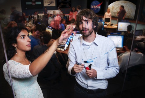
Our Search and Rescue office, based out of our Goddard Space Flight Center, researches and develops emergency beacon technology, passing the technology to companies who manufacture the beacons, making them available to the public at retail stores. The beacons are designed for personal, maritime and aviation use.

The search and rescue network, Cospas-Sarsat, is an international program that ensures the compatibility of distress alert services with the needs of users. Its current space segment relies on instruments onboard low-Earth and geosynchronous orbiting satellites, hundreds to thousands of miles above us.
Space instruments forward distress signals to the search and rescue ground segment, which is operated by partner organizations around the world! They manage specific regions of the ground network. For example, the National Oceanic and Atmospheric Administration (NOAA) operates the region containing the United States, which reaches across the Atlantic and Pacific Oceans as well as parts of Central and South America.

NOAA notifies organizations that coordinate search and rescue efforts of a 406 MHz distress beacon’s activation and location. Within the U.S., the U.S. Air Force responds to land-based emergencies and the U.S. Coast Guard responds to water-based emergencies. Local public service organizations like police and fire departments, as well as civilian volunteers, serve as first responders.

Here at NASA, we research, design and test search and rescue instruments and beacons to refine the existing network. Aeronautical beacon tests took place at our Langley Research Center in 2015. Using a 240-foot-high structure originally used to test Apollo spacecraft, our Search and Rescue team crashed three planes to test the survivability of these beacons, developing guidelines for manufacturers and installation into aircraft.

In the future, first responders will rely on a new constellation of search and rescue instruments on GPS systems on satellites in medium-Earth orbit, not hundreds, but THOUSANDS of miles overhead. These new instruments will enable the search and rescue network to locate a distress signal more quickly than the current system and achieve accuracy an order of magnitude better, from a half mile to approximately 300 feet. Our Search and Rescue office is developing second-generation 406 MHz beacons that make full use of this new system.

We will also incorporate these second-generation beacons into the Orion Crew Survival System. The Advanced Next-Generation Emergency Locator (ANGEL) beacons will be attached to astronaut life preservers. After splashdown, if the Orion crew exits the capsule due to an emergency, these beacons will make sure we know the exact location of floating astronauts! Our Johnson Space Center is testing this technology for used in future human spaceflight and exploration missions.

If you’re the owner of an emergency beacon, remember that beacon registration is free, easy and required by law.
To register your beacon, visit: beaconregistration.noaa.gov
Make sure to follow us on Tumblr for your regular dose of space: http://nasa.tumblr.com
More Posts from Nasalangley and Others

NASA Astronomy Picture of the Day 2016 April 6
Auroras and the Magnetosphere of Jupiter
Jupiter has auroras. Like near the Earth, the magnetic field of our Solar System’s largest planet compresses when impacted by a gust of charged particles from the Sun. This magnetic compression funnels charged particles towards Jupiter’s poles and down into the atmosphere. There, electrons are temporarily excited or knocked away from atmospheric gases, after which, when de-exciting or recombining with atmospheric ions, auroral light is emitted. The featured illustration portrays the magnificent magnetosphere around Jupiter in action. In the inset image released last month, the Earth-orbiting Chandra X-ray Observatory shows unexpectedly powerful X-ray light emitted by Jovian auroras, depicted in false-colored purple. That Chandra inset is superposed over an optical image taken at a different time by the Hubble Space Telescope. This aurora on Jupiter was seen in October 2011, several days after the Sun emitted a powerful Coronal Mass Ejection (CME).

Hubble Finds a Lenticular Galaxy Standing Out in the Crowd
A lone source shines out brightly from the dark expanse of deep space, glowing softly against a picturesque backdrop of distant stars and colorful galaxies.
Captured by the NASA/ESA Hubble Space Telescope’s Advanced Camera for Surveys (ACS), this scene shows PGC 83677, a lenticular galaxy — a galaxy type that sits between the more familiar elliptical and spiral varieties.
It reveals both the relatively calm outskirts and intriguing core of PGC 83677. Here, studies have uncovered signs of a monstrous black hole that is spewing out high-energy X-rays and ultraviolet light.
Text Credit: ESA (European Space Agency)
There are amazing opportunities at each center. Learn more at: https://intern.nasa.gov
So you want to work at NASA?
An out of this world career or internship might not be as far out of reach as you think. Check out all the ways you can get involved!
If you’re a student…

Our internships are the perfect place to start! We offer paid internships for spring, summer, and fall semesters to U.S. citizens currently attending an accredited university full time. Learn more at: https://intern.nasa.gov
Seriously considering a job in the Federal civil service? Check out the Pathways Internship Program which allows you to do multiple work tours while you finish school: http://nasajobs.nasa.gov/studentopps/employment/iep.htm
If you’re a recent graduate…
If you’re a U.S. citizen who has graduated from an accredited college or university within the past 2 years (or 6 if you have served in the military), then the our Recent Graduates program is just for you. Accepted applicants are placed in a 1 year career development program with the possibility of an additional year, or even granted term or permanent jobs within the agency. Learn more at: http://nasajobs.nasa.gov/studentopps/employment/rgp.htm.
If you’re a professional…

You can search for our job openings any time at USAJobs.com. Create an account, then use the USAJobs resume builder. Want to make sure your resume maximizes your opportunity for a job at NASA? Check out our Applicant Guide: https://applyonline.nasa.gov/applicant_guide.html.
You can then search for our job openings here: https://nasai.usajobs.gov/.
If you want to be an astronaut…

Astronaut candidate applications are accepted every few years- including right now! Get yours in before the current application closes on February 18, 2016.
Do you have a bachelor’s degree in a STEM field and 3 years of related professional experience? You might be eligible. Find out more and apply online at: https://nasai.usajobs.gov/GetJob/ViewDetails/423817000.
Make sure to follow us on Tumblr for your regular dose of space: http://nasa.tumblr.com
Click on the link to the full article to see how NASA’s Langley Research Center is changing the way we conceptualize commercial flight!
NASA Aeronautics Budget Proposes Return of X-Planes
Edwards AFB CA (SPX) Feb 19, 2016 NASA is researching ideas that could lead to developing an electric propulsion-powered aircraft that would be quieter, more efficient and environmentally friendly than today’s commuter aircraft. The proposed piloted experimental airplane is called Sceptor, short for the Scalable Convergent Electric Propulsion Technology and Operations Research. The concept involves removing the wing from a Full article
SAGE III Science Data Validation Efforts Begin

From its perch on the International Space Station, SAGE III is measuring stratospheric ozone as well as other gases and aerosols.
An orbiting science instrument whose legacy dates back 34 years continues to beam back data on Earth’s protective ozone layer – this time, from a perch on the hull of the International Space Station.
The Stratospheric Aerosol and Gas Experiment III (SAGE III), a NASA Langley Research Center-led mission, was launched on Feb. 19, 2017 and installed on the International Space Station during a 10-day robotic operation.
Since March 2017, the instrument has been measuring and collecting data on Earth’s sunscreen, stratospheric ozone, as well as other gases and aerosols, which are tiny particles in the atmosphere at all altitudes.
The SAGE III instrument makes these measurements through occultation, which involves looking at the light from the Sun or the Moon as it passes through Earth’s atmosphere at the edge, or limb, of the planet. The initial set of atmospheric data collected from the SAGE III instrument was released publicly in October 2017, and the first lunar data was released in January 2018.
Because the SAGE III instrument makes measurements through remote sensing - collecting data from some distance away - the science validation team cannot be sure if the data they are receiving is accurate without first validating it.
To do that, SAGE III science data must be compared to in-situ measurements, or measurements made by other instruments or systems that come in direct contact with the ozone, aerosol, or gas data being collected. These in-situ measurements are collected by the Network for Detection of Atmospheric Composition Change (NDACC), an international group, part of the National Oceanic and Atmospheric Administration, composed of research sites across the world collecting data on the Earth’s atmosphere.
“These sites have been vetted, validated, and have a long statistical history of making science measurements with their instruments,” said SAGE III Science Manager Marilee Roell.
The NDACC will collect these validated measurements through various methods, with two primary methods being through lidar - light detection and ranging - and sondes. Lidar is a ground-based measurement technique that uses a laser to shoot a beam into the Earth’s atmosphere, causing light to scatter by the atmospheric gases and particles. Being able to detect the distance to these gases and particles, the lidar can gather data on the Earth’s atmospheric composition.
Sondes are lightweight, balloon-borne instruments that are flown thousands of feet into the Earth’s atmosphere. As the instrument ascends, it transmits measurements of particle and gas concentrations by radio to a ground-based receiving station. Sondes are used daily across the globe to capture meteorological data, allowing people to check weather conditions each morning.
The science validation team is using NDACC ozone and aerosol lidar data, as well as ozone and water vapor sonde measurements, to validate science data collected from SAGE III.
“We want to match our vertical science product to an externally validated source. It helps the science community have confidence in our data set,” said Roell.
The team is working towards having an externally validated aerosol sonde to compare to the collected SAGE III data. This effort is in the preliminary stages of validating the aerosol balloon sonde against a suite of aerosol sounders, including lidar.
The team is working to validate science data with NDACC locations in Boulder, Colorado and Lauder, New Zealand, which fall within similar latitude bands in the northern and southern hemispheres. To be precise in validation efforts, the lidar or sonde measurement is taken at the same time and location that SAGE III is passing over and collecting equivalent data.
One of the most recent validation efforts took place in Table Mountain, California, and Haute Provence in France. Both locations include validated lidar systems, with lidar being operated by NASA’s Jet Propulsion Laboratory in Table Mountain, California.
Validation efforts were taken a step further by including a third source of measurements: NASA’s DC-8 aircraft. The aircraft, based out of NASA Armstrong Flight Research Center in Palmdale, California, operates as a flying science laboratory. It helps validate the accuracy of other remote-sensing satellite data, such as SAGE III, and can fly under the satellite’s path to collect the same measurements.
Validating the science data using this method required SAGE III, the NASA DC-8 aircraft, and the lidar system in California or France to be taking measurements at the same time and location. The science validation team worked to have all three systems line up while taking measurements and collected some coinciding science data.
NASA also created a validation website for other NDACC sites to use. The site displays SAGE III overpasses of NDACC sites that are three weeks out or less. These sites can choose to make lidar or sonde measurements at the same time as the instrument overpass, and compare them to SAGE III data collected to see if the two sets coincide. The validation team is pursuing additional NDACC sites to coordinate overpass timeframes when the sites may be taking lidar and sonde measurements.
The SAGE III team will present initial science validation data at the European Geosciences Union conference in Vienna, Austria this April.
SAGE III is the latest in a legacy of Langley instruments that go back to the Stratospheric Aerosol Measurement (SAM), which flew on the 1975 Apollo-Soyuz mission. SAGE II, operational from 1984 to 2005, measured global declines in stratospheric ozone that were later shown to be caused by human-induced increases in atmospheric chlorine. Data from it and other sources led to the development of the Montreal Protocol on Substances that Deplete the Ozone Layer.
After the passage of the protocol, SAGE II data also provided key evidence that the ozone layer was showing signs of recovery.
SAGE III, which launched to the station Feb. 19 from Kennedy Space Center in Florida, will continue to monitor that recovery, but with more of Earth’s atmosphere in its sights. SAGE II monitored only the stratosphere. SAGE III is monitoring both the stratosphere and the mesosphere, which is the layer directly above the stratosphere.
Ozone in the upper atmosphere acts as Earth’s sunscreen, protecting the surface from cancer-causing, crop-damaging ultraviolet rays. Atmospheric aerosols contribute to variability in the climate record.
Allison Leybold NASA Langley Research Center
NASA’s Hubble Spots Possible Water Plumes Erupting on Jupiter's Moon Europa

This composite image shows suspected plumes of water vapor erupting at the 7 o’clock position off the limb of Jupiter’s moon Europa. The plumes, photographed by NASA’s Hubble’s Space Telescope Imaging Spectrograph, were seen in silhouette as the moon passed in front of Jupiter. Hubble’s ultraviolet sensitivity allowed for the features -- rising over 100 miles (160 kilometers) above Europa’s icy surface -- to be discerned. The water is believed to come from a subsurface ocean on Europa. The Hubble data were taken on January 26, 2014. The image of Europa, superimposed on the Hubble data, is assembled from data from the Galileo and Voyager missions.Credits: NASA/ESA/W. Sparks (STScI)/USGS Astrogeology Science Center
Astronomers using NASA's Hubble Space Telescope have imaged what may be water vapor plumes erupting off the surface of Jupiter's moon Europa. This finding bolsters other Hubble observations suggesting the icy moon erupts with high altitude water vapor plumes.
The observation increases the possibility that missions to Europa may be able to sample Europa’s ocean without having to drill through miles of ice.
“Europa’s ocean is considered to be one of the most promising places that could potentially harbor life in the solar system,” said Geoff Yoder, acting associate administrator for NASA’s Science Mission Directorate in Washington. “These plumes, if they do indeed exist, may provide another way to sample Europa’s subsurface.”
The plumes are estimated to rise about 125 miles (200 kilometers) before, presumably, raining material back down onto Europa's surface. Europa has a huge global ocean containing twice as much water as Earth’s oceans, but it is protected by a layer of extremely cold and hard ice of unknown thickness. The plumes provide a tantalizing opportunity to gather samples originating from under the surface without having to land or drill through the ice.
The team, led by William Sparks of the Space Telescope Science Institute (STScI) in Baltimore observed these finger-like projections while viewing Europa's limb as the moon passed in front of Jupiter.
The original goal of the team's observing proposal was to determine whether Europa has a thin, extended atmosphere, or exosphere. Using the same observing method that detects atmospheres around planets orbiting other stars, the team realized if there was water vapor venting from Europa’s surface, this observation would be an excellent way to see it.
"The atmosphere of an extrasolar planet blocks some of the starlight that is behind it," Sparks explained. "If there is a thin atmosphere around Europa, it has the potential to block some of the light of Jupiter, and we could see it as a silhouette. And so we were looking for absorption features around the limb of Europa as it transited the smooth face of Jupiter."
In 10 separate occurrences spanning 15 months, the team observed Europa passing in front of Jupiter. They saw what could be plumes erupting on three of these occasions.
This work provides supporting evidence for water plumes on Europa. In 2012, a team led by Lorenz Roth of the Southwest Research Institute in San Antonio, detected evidence of water vapor erupting from the frigid south polar region of Europa and reaching more than 100 miles (160 kilometers) into space. Although both teams used Hubble's Space Telescope Imaging Spectrograph instrument, each used a totally independent method to arrive at the same conclusion.
"When we calculate in a completely different way the amount of material that would be needed to create these absorption features, it's pretty similar to what Roth and his team found," Sparks said. "The estimates for the mass are similar, the estimates for the height of the plumes are similar. The latitude of two of the plume candidates we see corresponds to their earlier work."
But as of yet, the two teams have not simultaneously detected the plumes using their independent techniques. Observations thus far have suggested the plumes could be highly variable, meaning that they may sporadically erupt for some time and then die down. For example, observations by Roth’s team within a week of one of the detections by Sparks’ team failed to detect any plumes.
If confirmed, Europa would be the second moon in the solar system known to have water vapor plumes. In 2005, NASA's Cassini orbiter detected jets of water vapor and dust spewing off the surface of Saturn's moon Enceladus.
Scientists may use the infrared vision of NASA’s James Webb Space Telescope, which is scheduled to launch in 2018, to confirm venting or plume activity on Europa. NASA also is formulating a mission to Europa with a payload that could confirm the presence of plumes and study them from close range during multiple flybys.
“Hubble’s unique capabilities enabled it to capture these plumes, once again demonstrating Hubble’s ability to make observations it was never designed to make,” said Paul Hertz, director of the Astrophysics Division at NASA Headquarters in Washington. “This observation opens up a world of possibilities, and we look forward to future missions -- such as the James Webb Space Telescope -- to follow up on this exciting discovery.”
The work by Sparks and his colleagues will be published in the Sept. 29 issue of the Astrophysical Journal.
The Hubble Space Telescope is a project of international cooperation between NASA and ESA (the European Space Agency.) NASA's Goddard Space Flight Center in Greenbelt, Maryland, manages the telescope. STScI, which is operated for NASA by the Association of Universities for Research in Astronomy in Washington, conducts Hubble science operations.
For images and more information about Europa and Hubble, visit:
http://www.nasa.gov/hubble & http://hubblesite.org/news/2016/33
Sean Potter / Laurie Cantillo Headquarters, Washington 202-358-1536 / 202-358-1077 sean.potter@nasa.gov / laura.l.cantillo@nasa.gov
Ann Jenkins / Ray Villard Space Telescope Science Institute, Baltimore 410-338-4488 / 410-338-4514 jenkins@stsci.edu / villard@stsci.edu
RELEASE 16-096

At Hangar, Raptors Find Shelter from the Storm
As Tropical Storm Hermine charged up the East Coast Sept. 2, 2016, Langley Air Force Base reached out to the Research Services Directorate and NASA Langley Research Center hangar manager Dale Bowser to see if NASA Langley could store a few F-22 Raptors. Even though the hangar in Hampton, Virginia, already had a large visitor — a C-130 from the Wallops Flight Facility on Virginia’s Eastern Shore — the hangar was able to carefully sandwich in more than a dozen Air Force fighters and offer them protection from the wind. NASA Langley photographer David C. Bowman captured the image using a fish-eye lens and shooting down from the hangar's catwalk some 70 feet above the building's floor.
The hangar provides 85,200 square feet (7,915 square meters) of open space and large door dimensions that allow for entry of big aircraft such as Boeing 757s and other commercial or military transport-class planes. The hangar normally is home to 13 of NASA Langley's own research aircraft, when they are not out doing atmospheric science or aeronautics research. Still, there is enough space to share with neighboring Langley Air Force Base during emergencies. The facility is rated for at least a Category 2 hurricane. Built in the early 1950s, it was designed to fit a B-36. It can also accommodate the Super Guppy, which visited NASA Langley in 2014.
Image credit: NASA/David C. Bowman


Posing in the wind tunnel. Via NASA Langley.

Vibration test at 80% power of the European Structural Test Article conducted at NASA Glenn’s Space Power Facility at Plum Brook Station, Sandusky, Ohio.
-
 schofnedhustrigh liked this · 1 year ago
 -
 may2217 reblogged this · 3 years ago
 -
 massagemental40-blog liked this · 3 years ago