Passkale - Untitled

More Posts from Passkale and Others


21 Years of Amazing Earth Imagery
On April 29, 1999, NASA Earth Observatory started delivering science stories and imagery to the public through the Internet. Today, we turn 21! So much has changed in the past two decades…
One of the most notable changes is the way we view our home planet. Check out some of the beautiful imagery of our planet over the past 21 years.
2000: Pine Island Glacier

Most people will never see Pine Island Glacier in person. Located near the base of the Antarctic Peninsula—the “thumb” of the continent—the glacier lies more than 2,600 kilometers (1,600 miles) from the tip of South America. That’s shorter than a cross-country flight from New York to Los Angeles, but there are no runways on the glacier and no infrastructure. Only a handful of scientists have ever set foot on its ice.
This animation shows a wide view of Pine Island Glacier and the long-term retreat of its ice front. Images were acquired by the Moderate Resolution Imaging Spectroradiometer (MODIS) on our Terra satellite from 2000 to 2019. Notice that there are times when the front appears to stay in the same place or even advance, though the overall trend is toward retreat. Read more.
2002: The Blue Marble

In February 2002, Earth Observatory published this “blue marble” image based on the most detailed collection of true-color imagery of the entire Earth at that time. Using a collection of satellite-based observations, scientists and visualizers stitched together months of observations of the land surface, oceans, sea ice and clouds into a seamless, true-color mosaic of every square kilometer (.386 square mile) of our planet. Most of the information contained in this image came from Moderate Resolution Imaging Spectrometer (MODIS), illustrating the instrument’s outstanding capacity to act as an integrated tool for observing a variety of terrestrial, oceanic and atmospheric features of the Earth. Read more.
2009: Tsauchab River Bed

The Tsauchab River is a famous landmark for the people of Namibia and tourists. Yet few people have ever seen the river flowing with water. In December 2009, an astronaut on the International Space Station caught this glimpse of the Tsauchab River bed jutting into the sea of red dunes. It ends in a series of light-colored, silty mud holes on the dry lake floor.
Like several other rivers around the Namib Desert, the Tsauchab brings sediment down from the hinterland toward the coastal lowland. This sediment is then blown from the river beds, and over tens of millions of years it has accumulated as the red dunes of the Namib Sand Sea. Read more.
2012: Manning Island and Foxe Basin, Canada

Although it may look like a microscope’s view of a thin slice of mineral-speckled rock, this image was actually acquired in space by the Earth Observing-1 satellite in July 2012. It shows a small set of islands and a rich mixture of ice in Foxe Basin, the shallow northern reaches of Hudson Bay.
The small and diverse sizes of the ice floes indicate that they were melting. The darkest colors in the image are open water. Snow-free ice appears gray, while snow-covered ice appears white. The small, dark features on many of the floes are likely melt ponds. Read more.
2013: A Lava Lamp Look at the Atlantic

Stretching from tropical Florida to the doorstep of Europe, this river of water carries a lot of heat, salt, and history. The Gulf Stream is an important part of the global ocean conveyor belt that moves water and heat across the North Atlantic from the equator toward the poles. It is one of the strongest currents on Earth, and one of the most studied.
This image shows a small portion of the Gulf Stream as it appears in infrared imagery. Data for this image was acquired on April 9, 2013, by the Thermal Infrared Sensor (TIRS) on the Landsat 8 satellite. TIRS observes in wavelengths of 10.9 micrometers and 12.0 micrometers. The image above is centered at 33.06° North latitude, 73.86° West longitude, about 500 kilometers (300 miles) east of Charleston, South Carolina. Read more.
2016: Curious Ensemble of Wonderful Features

When John Wesley Powell explored the Colorado River in 1869, he made the first thorough survey of one of the last blank spots on the map. The expedition began in May at Green River, Wyoming, and ended three months later at the confluence of the Colorado and Virgin Rivers in present-day Nevada.
About two months into their journey, the nine men of the expedition found themselves in Glen Canyon. As the men traveled along the serpentine river channel, they encountered what Powell later described in Canyons of Colorado as a “curious ensemble of wonderful features.”
From above, the view of Glen Canyon is equally arresting. In 2016, an astronaut aboard the International Space Station took several photographs that were combined to make a long mosaic. The water has an unnatural shade of blue because of sunglint, an optical phenomenon that occurs when sunlight reflects off the surface of water at the same angle that a camera views it. Click here to see the long mosaic.
2019: Lena Delta Shakes Off Water

For most of the year, the Lena River Delta—a vast wetland fanning out from northeast Siberia into the Arctic Ocean—is either frozen over and barren or thawed out and lush. Only briefly will you see it like this.
After seven months encased in snow and ice, the delta emerges for the short Arctic summer. The transition happens fast. The animation above, composed of images from the Moderate Resolution Imaging Spectroradiometer (MODIS) on our Aqua satellite, shows the transformation from June 3-10, 2019. Read more.
2020: Making Waves in the Andaman Sea

When tides, currents and gravity move water masses over seafloor features, they can create wave actions within the ocean. Oceanographers began studying these internal waves from ships in the 1960s, and the modern era of satellites has made it possible to see them on a grand scale. The Operational Land Imager (OLI) on Landsat 8 captured these images of the Andaman Sea on November 29, 2019. The reflection of the Sun on the ocean—sunglint—helps make the internal waves visible.
Internal waves form because the ocean is layered. Deep water tends to be colder, denser and saltier, while shallower water is often warmer, lighter and fresher. The differences in density and salinity cause layers of the ocean to behave like different fluids. When tides, currents, gravity and Earth’s rotation move these different water masses over seafloor formations (such as ridges or canyons), they create waves within the sea. Read more.
These images were taken from NASA Earth Observatory!
Interested in receiving Earth Observatory’s Images of the Day? Subscribe to our newsletters or RSS feeds.
Make sure to follow us on Tumblr for your regular dose of space: http://nasa.tumblr.com.

Video on pulling a handle and attaching to a mug on clipzine.me.


Scott Wheeler was born and raised in what’s known as the Northeast Kingdom, the rugged and beautiful countryside where Vermont abuts Canada. Even so, he didn’t realize he was supposed to check in with Canadian immigration authorities when driving across the border recently.
Two polite, officious Mounties tell him to make a U-turn and follow them back to the port of entry where he’s questioned about his intentions inside Quebec. He explains his mistake, and eventually, the Mounties return his identification and he’s free to go.
“That’s pretty much life on the border; it’s changing,” Wheeler says, resignedly.
While the southern border gets all the attention with President Trump’s massive wall and the backlog of desperate asylum-seekers stuck in Mexico, things are tense on the northern border with Canada, as well. The number of illegal crossers is on the rise. And residents complain that heightened security has changed the character of the once-neighborly frontier.
“It’s even confusing for a local to understand,” says Wheeler, a former state representative and history buff who publishes the Northland Journal. “Back when I was growing up, you could come across the border with a wave to the border agents.”
“It’s a barrier, and we feel it”
In the past two fiscal years, U.S. Customs and Border Protection has logged a 400% jump in apprehensions of people crossing illegally from Canada. That’s the biggest increase anywhere along the 5,525-mile northern border.
Border authorities made it harder to cross freely after the Sept. 11 terrorist attacks, but things have gotten even stricter since President Trump took office.
Consider Canusa Avenue — the name is a hybrid of Canada and USA. The international boundary runs for a third of a mile along this street. This is where Wheeler inadvertently turned into Canada.
There are 14 houses, with Americans living on the south side of the street and Canadians on the north. Two residents recently met on their respective sides of the white boundary line.
“We cannot leave our street on our own free will,” says Janice Beadle, who describes herself as a retired snack bar owner, dairy worker and maple syrup maker.
U.S.-Canada Border Community’s Culture Changes As Security Tightens
Photos: Ian Thomas Jansen-Lonnquist for NPR


The making of the Mainframe Kid.
Connor Krukosky, aka The Mainframe Kid, got his first IBM computer when he was just 18 months old. At age 18, he bought, disassembled and rebuilt a 13-year-old, 1,500-pound IBM z890 mainframe computer. Now, he works at IBM.
Hear his story->
Two new Peterson guides for spring birding
Spring is finally here, so we’re looking for more and more excuses to get outside. One of our favorite ways to experience the outdoors is to go birding. Luckily, there are two new Peterson guides to help you identify birds through song and sight, when you’re hiking or enjoying the great outdoors.

Peterson Field Guide to Bird Sounds of Western North America
This is a comprehensive field guide that uses an innovative Sound Index to teach readers how to quickly identify unfamiliar songs and bird calls in western North America. Read an excerpt.
Learn more and purchase your copy
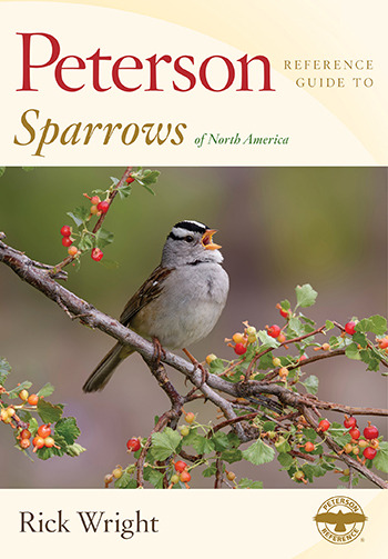
Peterson Reference Guide to Sparrows of North America
Sparrows are as complicated as they are common. This is an essential guide to to identifying 76 varieties, as well as fascinating history of human interactions with them. Read an excerpt.
Learn more and purchase your copy
Get updates on the latest Peterson releases and exclusive nature news by signing up for our newsletter
-
 bertonini liked this · 1 year ago
 -
 the-charming-sexy reblogged this · 2 years ago
 -
 charanadine liked this · 3 years ago
 -
 dentistdave liked this · 4 years ago
 -
 chamequinho5 liked this · 4 years ago
 -
man-beard-legend2 liked this · 4 years ago
-
voyeurismcouple1970her reblogged this · 4 years ago
-
 lijanaa liked this · 4 years ago
 -
 cumsumedbyhim liked this · 4 years ago
 -
 junkyardcentral liked this · 4 years ago
 -
 poesiasev liked this · 4 years ago
 -
 aristippos-stars-aka-maiandr0s reblogged this · 4 years ago
 -
aristippos-stars-aka-maiandr0s liked this · 4 years ago
-
mytendon reblogged this · 4 years ago
-
mytendon liked this · 4 years ago
-
 ootdh reblogged this · 4 years ago
 -
ootdh liked this · 4 years ago
-
 olivrsm liked this · 4 years ago
 -
 tenigam reblogged this · 4 years ago
 -
tenigam liked this · 4 years ago
-
 happyzenmonk liked this · 4 years ago
 -
cleanslatesandlatte reblogged this · 4 years ago
-
 olegario44 liked this · 4 years ago
 -
 rulasb7 liked this · 4 years ago
 -
 amostpeculiarman reblogged this · 4 years ago
 -
 khrayszie-ghurl-08 reblogged this · 4 years ago
 -
 thegirlwholikes reblogged this · 4 years ago