Curate, connect, and discover
Environment - Blog Posts

Ways NASA Studies the Ocean
We live on a water planet. The ocean covers a huge part of the Earth's surface – earning it the name Blue Marble.
The ocean is one of Earth’s largest ecosystems and helps moderate Earth’s climate. NASA scientists spend a lot of time studying the ocean and how it is changing as Earth’s climate changes.
In the last few years, NASA has launched an array of missions dedicated to studying this precious part of our planet, with more to come. For World Oceans Month, which starts in June, here are new ways NASA studies the ocean.
1. Seeing the colors of the ocean 🎨
A new NASA mission called PACE will see Earth’s oceans in more color than ever before. The color of the ocean is determined by the interaction of sunlight with substances or particles present in seawater.
Scheduled to launch in 2024, PACE will help scientists assess ocean health by measuring the distribution of phytoplankton, tiny plants and algae that sustain the marine food web. PACE will also continue measuring key atmospheric variables associated with air quality and Earth's climate.

2. Surveying surface water around the globe 💧
The SWOT satellite, launched in late 2022, is studying Earth’s freshwater – from oceans and coasts to rivers, lakes and more – to create the first global survey of Earth’s surface water.
SWOT is able to measure the elevation of water, observing how major bodies of water are changing and detecting ocean features. The data SWOT collects will help scientists assess water resources, track regional sea level changes, monitor changing coastlines, and observe small ocean currents and eddies.

3. Setting sail to understand interactions between the ocean and atmosphere 🚢
With research aircraft, a research ship, and autonomous ocean instruments like gliders, NASA’s S-MODE mission is setting sail to study Earth’s oceans up close. Their goal? To understand ocean whirlpools, eddies and currents.
These swirling ocean features drive the give-and-take of nutrients and energy between the ocean and atmosphere and, ultimately, help shape Earth’s climate.

4. Building ocean satellites the size of a shoebox 📦
NASA’s HawkEye instrument collects ocean color data and captures gorgeous images of Earth from its orbit just over 355 miles (575 kilometers) above Earth’s surface. It’s also aboard a tiny satellite measuring just 10cm x 10 cm x 30 cm – about the size of a shoebox!

5. Designing new missions to study Earth’s oceans! 🌊
NASA is currently designing a new space-based instrument called GLIMR that will help scientists observe and monitor oceans throughout the Gulf of Mexico, the southeastern U.S. coastline and the Amazon River plume that stretches to the Atlantic Ocean. GLIMR will also provide important information about oil spills, harmful algae blooms, water quality and more to local agencies.

6. Taking the ocean to new heights ⬆️
The U.S.-European Sentinel-6 Michael Freilich satellite is helping researchers measure the height of the ocean - a key component in understanding how Earth’s climate is changing.
This mission, which launched in 2020, has a serious job to do. It’s not only helping meteorologists improve their weather forecasts, but it’s helping researchers understand how climate change is changing Earth’s coastlines in real time.
Make sure to follow us on Tumblr for your regular dose of space!
Why Isn’t Every Year the Warmest Year on Record?
This just in: 2022 effectively tied for the fifth warmest year since 1880, when our record starts. Here at NASA, we work with our partners at NOAA to track temperatures across Earth’s entire surface, to keep a global record of how our planet is changing.
Overall, Earth is getting hotter.

The warming comes directly from human activities – specifically, the release of greenhouse gases like carbon dioxide from burning fossil fuels. We started burning fossil fuels in earnest during the Industrial Revolution. Activities like driving cars and operating factories continue to release greenhouse gases into our atmosphere, where they trap heat in the atmosphere.

So…if we’re causing Earth to warm, why isn’t every year the hottest year on record?
As 2022 shows, the current global warming isn’t uniform. Every single year isn’t necessarily warmer than every previous year, but it is generally warmer than most of the preceding years. There’s a warming trend.
Earth is a really complex system, with various climate patterns, solar activity, and events like volcanic eruptions that can tip things slightly warmer or cooler.
Climate Patterns
While 2021 and 2022 continued a global trend of warming, they were both a little cooler than 2020, largely because of a natural phenomenon known as La Niña.
La Niña is one third of a climate phenomenon called El Niño Southern Oscillation, also known as ENSO, which can have significant effects around the globe. During La Niña years, ocean temperatures in the central and eastern Pacific Ocean cool off slightly. La Niña’s twin, El Niño brings warmer temperatures to the central and eastern Pacific. Neutral years bring ocean temperatures in the region closer to the average.

El Niño and La Niña affect more than ocean temperatures – they can bring changes to rainfall patterns, hurricane frequency, and global average temperature.
We’ve been in a La Niña mode the last three, which has slightly cooled global temperatures. That’s one big reason 2021 and 2022 were cooler than 2020 – which was an El Niño year.
Overall warming is still happening. Current El Niño years are warmer than previous El Niño years, and the same goes for La Niña years. In fact, enough overall warming has occurred that most current La Niña years are warmer than most previous El Niño years. This year was the warmest La Niña year on record.

Solar Activity
Our Sun cycles through periods of more and less activity, on a schedule of about every 11 years. Here on Earth, we might receive slightly less energy — heat — from the Sun during quieter periods and slightly more during active periods.

At NASA, we work with NOAA to track the solar cycle. We kicked off a new one – Solar Cycle 25 – after solar minimum in December 2019. Since then, solar activity has been slightly ramping up.
Because we closely track solar activity, we know that over the past several decades, solar activity hasn't been on the rise, while greenhouse gases have. More importantly, the "fingerprints" we see on the climate, including temperature changes in the upper atmosphere, don't fit the what we'd expect from solar-caused warming. Rather they look like what we expect from increased greenhouse warming, verifying a prediction made decades ago by NASA.
Volcanic Eruptions
Throughout history, volcanoes have driven major shifts in Earth’s climate. Large eruptions can release water vapor — a greenhouse gas like carbon dioxide — which traps additional warmth within our atmosphere.
On the flip side, eruptions that loft lots of ash and soot into the atmosphere can temporarily cool the climate slightly, by reflecting some sunlight back into space.
Like solar activity, we can monitor volcanic eruptions and tease out their effect on variations in our global temperature.

At the End of the Day, It’s Us
Our satellites, airborne missions, and measurements from the ground give us a comprehensive picture of what’s happening on Earth every day. We also have computer models that can skillfully recreate Earth’s climate.
By combining the two, we can see what would happen to global temperature if all the changes were caused by natural forces, like volcanic eruptions or ENSO. By looking at the fingerprints each of these climate drivers leave in our models, it’s perfectly clear: The current global warming we’re experiencing is caused by humans.
For more information about climate change, visit climate.nasa.gov.
Make sure to follow us on Tumblr for your regular dose of space!
NASA Spotlight: Carbon Cycle and Ecosystems Earth Scientist Erika Podest
Dr. Erika Podest is a scientist with the Carbon Cycle and Ecosystems Group in our Jet Propulsion Laboratory’s Earth Science Division and Visiting Associate Researcher in the Joint Institute for Regional Earth System Science and Engineering (JIFRESSE) at UCLA. Her research entails using satellite images to study Earth’s ecosystems specifically related to wetlands and boreal forests and how they are being affected by climate change.
Erika took time from studying our home planet to answer questions about her life and career! Get to know our Earth Scientist:
What inspires/motivates you?
I am inspired by the beauty of nature, its perfection and by the peace it brings me. My motivation is to make a positive impact on our planet by better understanding it and caring for it.
What first sparked your interest in Earth science?
I was born and raised in Panama, which is a country with an exuberant nature. Since I can remember, I was always surrounded by nature because my father was an adventurer who loved the outdoors and always took me with him to go exploring or simply to enjoy a nice relaxing day outside. This led me to develop a deep sense of appreciation, respect, and curiosity for nature, which sparked my interest to learn about it and pursue a career in Earth Science.
What got you interested in the study of Earth from space?

Early in my college years I was training for my private pilot’s license and during my solo flights I would take pictures of features on the surface from the plane. I was always amazed at the details the pictures showed of the landscape that were not obvious from the ground. This was the first step towards discovering that there was a field for studying Earth from above, called remote sensing and consequently my Masters and Ph.D. were focused in this field.
What technology, discovery, or policy do you think has the most potential to decrease humans’ environmental impact (e.g. wind turbines, carbon taxes, clean meat)?
I don’t think it is a matter of any one technology, discovery or policy. It is a combination of everything. Having an impact on climate change involves every level and direction, from the bottom up at the individual, grassroots and community level to the top down at the policy level. As individuals, I think it is important to educate ourselves about climate change (I suggest climate.nasa.gov). We all have the power to make a positive change by speaking up and making informed decisions about our consumptive habits.
What’s a fact about the role of wetlands and boreal forests in the global ecosystem that you think would surprise people?

Wetlands provide a vital role in carbon storage. Even though they cover about 5-8% of the Earth’s land surface, studies indicate that they contain a disproportionate amount of our planet’s total soil carbon, about 20-30%. In addition, they are like the arteries and veins of the landscape, acting as water sources and purifiers and helping in flood control. They also protect our shores and harbor large amounts of biodiversity.
Boreal forests are found in the uppermost northern hemisphere (Alaska, most of Canada, Russia, Scandinavia and northern Asia) and account for about 30% of the world’s forest cover. These forests lock up enormous amounts of carbon and help slow the increasing buildup of carbon dioxide in our atmosphere. In their peak growth phase during the northern spring and summer, the worldwide levels of carbon dioxide fall and the worldwide levels of oxygen rise.
Can you describe a typical day on a research trip?

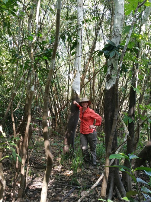
It depends on the research trip. For example, one of my more recent ones was to the Peruvian Amazon where we went upriver on a boat for three weeks on a major tributary of the Amazon River called the Ucuyali River. I was with a team of eight researchers and we were studying the wetland ecosystems of the Pacaya-Samiria Natural Reserve, which entailed making vegetation measurements and assessing inundation extent to validate our scientific findings from satellite observations. We camped for most of the trip and a typical day entailed waking up at around 5:00 am with a symphony of sounds that emerged from the forest, including monkeys. We had breakfast and set off from base camp into the forest (~1 hour walk) to work an 8-9 hour day with a short lunch break (we had packed lunches) at noon. At the end of the day I’d be drenched in sweat, sunscreen, insect repellent, and dust and I’d bathe with water from the river, which was as brown as a milk chocolate bar. It was the most refreshing and cleansing feeling! The day would close with dinner followed with a discussion of the measurements to be collected the following day. Lights were out by 7:30 pm (which seemed like midnight) and I’d re-emerge myself into my tent in the dark tropical night surrounded by the sounds of the forest, until the next morning.
What are some of the most important lessons you’ve learned in life?
That it is important to be patient, humble and thankful.
Do you have any secret skills, talents, or hobbies?
Great question! I do not have any secrete skills or talents but I do have a couple of hobbies. I play the piano, though I am still a novice. I love windsurfing. It is an amazing feeling to skim over the water at fast speeds (I’m also an adrenaline junkie). Finally, I am fascinated by magic card tricks and whenever I have some free time I like to learn a new trick.
What do you enjoy the most about your job?
I enjoy constantly learning about our natural world and how it works. I also really enjoy communicating my work to students and to the general public. I find it especially rewarding when I can educate people and motivate students to consider careers in science.
Erika, thank you for your time and everything you do to keep our home planet safe!
Make sure to follow us on Tumblr for your regular dose of space: http://nasa.tumblr.com.
See Why Our Researchers Explore Earth's Extreme and Remote Environments

When we talk about exploration in far-flung places, you might think of space telescopes taking images of planets outside our solar system, or astronauts floating on the International Space Station.

But did you know our researchers travel to some of Earth's most inaccessible and dangerous places, too?

Two scientists working with the ICESat-2 mission just finished a trek from the South Pole to latitude 88 south, a journey of about 450 miles. They had to travel during the Antarctic summer - the region's warmest time, with near-constant sunshine - but the trek was still over solid ice and snow.

The trip lasted 14 days, and was an important part of a process known as calibration and validation. ICESat-2 will launch this fall, and the team was taking extremely precise elevation measurements that will be used to validate those taken by the satellite.

Sometimes our research in Earth's remote regions helps us understand even farther-flung locations…like other planets.

Geologic features on Mars look very similar to islands and landforms created by volcanoes here on our home planet.

As hot jets of magma make their way to Earth's surface, they create new rocks and land - a process that may have taken place on Mars and the Moon.

In 2015, our researchers walked on newly cooled lava on the Holuhraun volcano in Iceland to take measurements of the landscape, in order to understand similar processes on other rocky bodies in our solar system.

There may not be flowing lava in the mangrove forests in Gabon, but our researchers have to brave mosquitoes and tree roots that reach up to 15-foot high as they study carbon storage in the vegetation there.

The scientists take some measurements from airplanes, but they also have to gather data from the ground in one our of planet's most pristine rainforests, climbing over and around roots that can grow taller than people. They use these measurements to create a 3-D map of the ecosystem, which helps them understand how much carbon in stored in the plants.

You can follow our treks to Earth’s most extreme locales on our Earth Expeditions blog.
Make sure to follow us on Tumblr for your regular dose of space: http://nasa.tumblr.com
How do space plants grow? This experiment on the International Space Station hopes to find out. Space-grown plants look mostly normal, but have some distinct features compared to plants grown on Earth – most notably in the way their roots grow.
Roots evolved to grow “down” to search out nutrients and water, and on Earth, that response is predominantly governed by the force of gravity. But how does a plant know which way is down when there is no “down”? What determines the direction in which the plant’s roots should grow in space?
We are studying the molecular genetic signals that help guide plant growth in the novel environment of spaceflight, including how plants use new molecular “tools” to sense and respond to their environment when familiar signals are absent. What we learn could improve the way we grow plants in microgravity on future space missions, enabling crews to use plants for food and oxygen. This is just one of many petri plates filled with tiny plants from the Characterizing Arabidopsis Root Attractions-2 (CARA-2) that was recently harvest aboard the space station.
Make sure to follow us on Tumblr for your regular dose of space: http://nasa.tumblr.com.
Applying Earth Observations Data to the Real World
In our DEVELOP Program, participants work on Earth science research projects and are mentored by science advisors from within the agency and from partner agencies, and extend research results to local communities.
This year, our partners ran the gamut from NASA centers to The National Oceanic and Atmospheric Agency (NOAA) to the University of Georgia to state and local governments. The one thing all have in common: using data from our Earth-observing satellites to inform such topics as disaster relief, preserving watershed and marshlands, working municipalities to provide health and study. The program also helps future scientists develop research and presentation skills.
Annually, the participants gather at NASA Headquarters to present their findings. From more than two dozen, we’re highlighting a cross section whose projects covered climate and invasive species in Alaska; health and air quality in Las Cruces; disaster preparation in the Philippines; and air quality in the Shenandoah Valley.
The projects demonstrate to community leaders how our science measurements and predictions can be used to address local policy issues. This year, DEVELOP features more than two dozen projects covering Earth science topics from all corners of the globe.
DEVELOP projects apply Earth observations to agriculture, climate, disasters, ecological forecasting, energy, health and air quality, oceans, water resources and weather. These projects highlight NASA Earth observation capabilities relative to environmental issues and concerns for enhanced policy and decision-making to improve life here on Earth.
DEVELOP projects apply Earth observations to agriculture, climate, disasters, ecological forecasting, energy, health and air quality, oceans, water resources and weather. These projects highlight NASA Earth observation capabilities relative to environmental issues and concerns for enhanced policy and decision-making to improve life here on Earth.
Visit the Develop Project page to learn more about the program and how to apply.
Make sure to follow us on Tumblr for your regular dose of space: http://nasa.tumblr.com
Diving into New Magnetic Territory with the MMS Mission
Our Magnetospheric Multiscale Mission, or MMS, is on a journey to study a new region of space.

On May 4, 2017, after three months of precisely coordinated maneuvers, MMS reached its new orbit to begin studying the magnetic environment on the ever-rotating nighttime side of Earth.

The space around Earth is not as empty as it looks. It’s packed with high energy electrons and ions that zoom along magnetic field lines and surf along waves created by electric and magnetic fields.

MMS studies how these particles move in order to understand a process known as magnetic reconnection, which occurs when magnetic fields explosively collide and re-align.

After launch, MMS started exploring the magnetic environment on the side of Earth closest to the sun. Now, MMS has been boosted into a new orbit that tops out twice as high as before, at over 98,000 miles above Earth’s surface.
The new orbit will allow the spacecraft to study magnetic reconnection on the night side of Earth, where the process is thought to cause the northern and southern lights and energize particles that fill the radiation belts, a doughnut-shaped region of trapped particles surrounding Earth.

MMS uses four separate but identical spacecraft, which fly in a tight pyramid formation known as a tetrahedron. This allows MMS to map the magnetic environment in three dimensions.

MMS made many discoveries during its first two years in space, and its new orbit will open the door to even more. The information scientists get from MMS will help us better understand our space environment, which helps in planning future missions to explore even further beyond our planet. Learn more about MMS at nasa.gov/mms.
Make sure to follow us on Tumblr for your regular dose of space: http://nasa.tumblr.com
Flying With Fuel From Plants: The Eco-friendly Way to Go
We eat them. We make medicines out of them. Now we’re learning how to use plants as airplane fuel that helps the environment.
Using biofuels to help power jet engines reduces particle emissions in their exhaust by as much as 50 to 70 percent, according to a new study that bodes well for airline economics and Earth’s atmosphere.

All of the aircraft, researchers and flight operations people who made ACCESS II happen. Credits: NASA/Tom Tschida
The findings are the result of a cooperative international research program led by NASA and involving agencies from Germany and Canada, and are detailed in a study published in the journal Nature.

The view from inside NASA's HU-25C Guardian sampling aircraft from very close behind the DC-8. Credits: NASA/SSAI Edward Winstead
Our flight tests collected information about the effects of alternative fuels on engine performance, emissions and aircraft-generated contrails – essentially, human-made clouds - at altitudes flown by commercial airliners.

The DC-8's four engines burned either JP-8 jet fuel or a 50-50 blend of JP-8 and renewable alternative fuel of hydro processed esters and fatty acids produced from camelina plant oil. Credits: NASA/SSAI Edward Winstead
Contrails are produced by hot aircraft engine exhaust mixing with the cold air that is typical at cruise altitudes several miles above Earth's surface, and are composed primarily of water in the form of ice crystals.

Matt Berry (left), a flight operations engineer at our Armstrong Flight Research Center, reviews the flight plan with Principal Investigator Bruce Anderson. Credits: NASA/Tom Tschida
Researchers are interested in contrails because they create clouds that would not normally form in the atmosphere, and are believed to influence Earth’s environment.
The alternative fuels tested reduced those emissions. That’s important because contrails have a larger impact on Earth’s atmosphere than all the aviation-related carbon dioxide emissions since the first powered flight by the Wright Brothers.

This photo, taken May 14, 2014, is from the CT-133 aircraft of research partner National Research Council of Canada. It shows the NASA HU-25C Guardian aircraft flying 250 meters behind NASA's DC-8 aircraft before it descends into the DC-8's exhaust plumes to sample ice particles and engine emissions. Credit: National Research Council of Canada
Researchers plan on continuing these studies to understand the benefits of replacing current fuels in aircraft with biofuels.
Make sure to follow us on Tumblr for your regular dose of space: http://nasa.tumblr.com